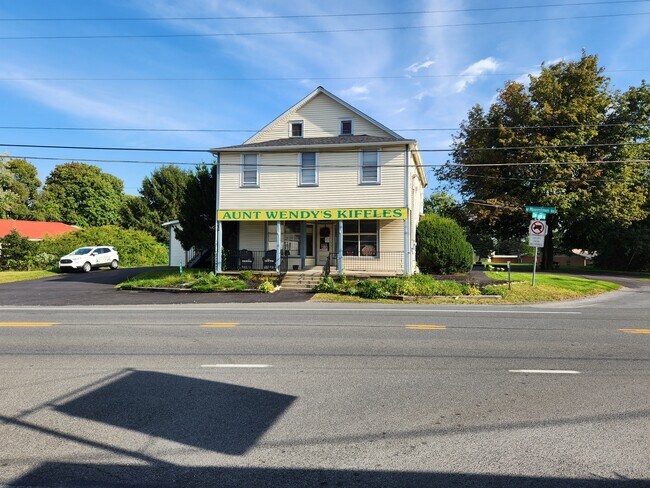
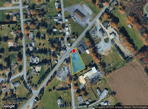
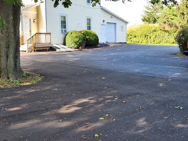
Property Record
354 W Moorestown Rd, Nazareth, PA 18064
NEARBY LISTINGS FOR SALE OR LEASE
Property Detail
354 W Moorestown Rd
Commercialofficeresidentialmixeduse
Northampton
X
Pennsylvania
42095C0140E
1.01 AC
2025
Lehigh Valley
2025
Philadelphia
016802
Allentown-Bethlehem-Easton, PA-NJ
3,615 SF
G7-11-21-0406
DEMOGRAPHICS near 354 W Moorestown Rd
1 Mile
3 Mile
5 Mile
2024 Total Population
1,493
8,905
34,475
2029 Population
1,494
8,934
34,624
Pop Growth 2024-2029
+ 0.07%
+ 0.33%
+ 0.43%
Average Age
42
44
45
2024 Total Households
523
3,319
13,327
HH Growth 2024-2029
+ 0.19%
+ 0.48%
+ 0.34%
Median Household Inc
$96,909
$96,738
$82,957
Avg Household Size
2.90
2.70
2.50
2024 Avg HH Vehicles
3.00
3.00
2.00
Median Home Value
$369,718
$331,802
$295,395
Median Year Built
1982
1982
1973
Nearby Places
Map Layers
Map Styles
 Street
 Aerial
- Restaurants
- Banks
- Shops
- Fitness
- Groceries
PUBLIC TRANSPORTATION
AIRPORT
Lehigh Valley International
DRIVE
WALK
Distance
Lehigh Valley International
21 min
13.0 mi
Freight Ports
Port of Philadelphia
DRIVE
WALK
Distance
Port of Philadelphia
106 min
78.8 mi
SALE & LEASE HISTORY
LISTING DATE
SALE/LEASE

Sep 16, 2022
For Sale
Nearby Properties
Address
Land Use
TOTAL SIZE
Lot Size
Zoning
Address
Land Use
TOTAL SIZE
Lot Size
Zoning
430,352 SF
57.60 AC
GC/I
Address
Land Use
TOTAL SIZE
Lot Size
Zoning
352,026 SF
1.84 AC
GC/I
Address
Land Use
TOTAL SIZE
Lot Size
Zoning
214,540 SF
25.69 AC
GC/I
Address
Land Use
TOTAL SIZE
Lot Size
Zoning
69,548 SF
9.18 AC
GC/I
Address
Land Use
TOTAL SIZE
Lot Size
Zoning
5,746 SF
89.51 AC
SR
Address
Land Use
TOTAL SIZE
Lot Size
Zoning
82,626 SF
18.96 AC
MDR
Address
Land Use
TOTAL SIZE
Lot Size
Zoning
48,084 SF
7.96 AC
RA
Address
Land Use
TOTAL SIZE
Lot Size
Zoning
5,106 SF
60.79 AC
RA
Address
Land Use
TOTAL SIZE
Lot Size
Zoning
380.48 AC
RC
Address
Land Use
TOTAL SIZE
Lot Size
Zoning
24,194 SF
2.25 AC
GC/I
Address
Land Use
TOTAL SIZE
Lot Size
Zoning
298.49 AC
RC
Address
Land Use
TOTAL SIZE
Lot Size
Zoning
313.05 AC
BMC
Address
Land Use
TOTAL SIZE
Lot Size
Zoning
9,960 SF
30.20 AC
RC
Address
Land Use
TOTAL SIZE
Lot Size
Zoning
4,200 SF
6 AC
GC
Address
Land Use
TOTAL SIZE
Lot Size
Zoning
16,862 SF
9 AC
R
Address
Land Use
TOTAL SIZE
Lot Size
Zoning
10,160 SF
4.40 AC
VC
Address
Land Use
TOTAL SIZE
Lot Size
Zoning
266.23 AC
CR
Address
Land Use
TOTAL SIZE
Lot Size
Zoning
10,384 SF
12.05 AC
LC
Address
Land Use
TOTAL SIZE
Lot Size
Zoning
19,141 SF
9.32 AC
HDR
Address
Land Use
TOTAL SIZE
Lot Size
Zoning
13,884 SF
1.46 AC
HDR
Address
Land Use
TOTAL SIZE
Lot Size
Zoning
15,360 SF
2.60 AC
R
Address
Land Use
TOTAL SIZE
Lot Size
Zoning
14,301 SF
3.70 AC
R
Address
Land Use
TOTAL SIZE
Lot Size
Zoning
7,800 SF
6.13 AC
HDR
Address
Land Use
TOTAL SIZE
Lot Size
Zoning
9,230 SF
3.37 AC
NC
Address
Land Use
TOTAL SIZE
Lot Size
Zoning
183.76 AC
RC
Address
Land Use
TOTAL SIZE
Lot Size
Zoning
90.70 AC
MDR
Address
Land Use
TOTAL SIZE
Lot Size
Zoning
2,468 SF
56.52 AC
LC
Address
Land Use
TOTAL SIZE
Lot Size
Zoning
77.66 AC
HDR
Address
Land Use
TOTAL SIZE
Lot Size
Zoning
8,096 SF
3.88 AC
HDR
Address
Land Use
TOTAL SIZE
Lot Size
Zoning
4,930 SF
1 AC
NC
The World's #1 Commercial Real Estate Marketplace
Connect with us
© 2025 CoStar Group
The information above has been obtained from sources believed reliable. While we do not doubt its accuracy we have not verified it and make no guarantee, warranty or representation about it. It is your responsibility to independently confirm its accuracy and completeness. Any projections, opinions, assumptions, or estimates used are for example only and do not represent the current or future performance of the property. The value of this transaction to you depends on tax and other factors which should be evaluated by your tax, financial, and legal advisors. You and your advisors should conduct a careful, independent investigation of the property to determine to your satisfaction the suitability of the property for your needs.